The next morning, tent wet from heavy
dew I waited for the sun to dry things out. Finally on my way, drove
down through nice woodland into Weston, a very old town, likely
really was the most westerly town when settled.
Nice old downtown,
surprisingly not all tarted up being so close to Kansas City, maybe
thirty miles south.
Driving south hugging the river, then
suddenly up over the bluffs to the east, nice dense woods and more
woods beyond, really the Missouri River the boundary between forest
and plains. Some say the west, the prairie west, begins at the 100th
meridian, which is not far west, and I recall Clark noting in his
journal how the woodland ended at the Missouri River and the tall
grass plains began, which makes Kansas City the beginning of the west
in these parts. Looking at my atlas, Kansas City is around 1100
miles of Washington, D.C, which would have seemed impossibly far in
Lewis and Clark's day. Portland and the Willamette valley, the
other side of the plains and the end og the Oregon Trail, is more
than half again as far – 1800 miles from Kansas City. I'm not sure
what to make of this, and the “west” the frontier, the wilderness
has always been moving west, and rapidly even before Daniel Boone.
There is a whole lot of the prairie west out there, much of it still
pretty wild.
Finally into Kansas City suburbs,
through North Kansas City and into downtown. Many old brick buildings rising up from the river, at the top of the bluff some new glass
towers but the scale is good, feels human and alive downtown.
Through downtown to Union Station where
my mother arrived in 1941 for WAC radio operator training, and where
she says folks gathered to ring in the New Year.
Good building,
better on the inside and recently restored, marble floors, a fine
freshly painted ceiling and chandelier style lights, restaurants,
coffee shop, museum, etc. but still in use as a train station.
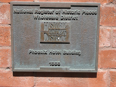
Back through downtown to the Historic
Garment District to find the Phoenix Hotel where mom stayed seventy
years ago. Nice old building, now an office and a jazz club, but
again restored and itself an historic landmark.
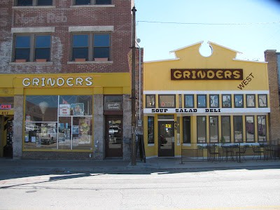
The entire area fine old buildings, former Garment District, itself an historic district and the buildings turning into condos, lofts, nice shops and businesses. Maybe history is respected here.
Wandering around, found famed 12th
street and Vine, vine closed off in both directions, one a park, the
other three story brick apartments, but a good long sign board with
the history of the area and the song. For many years, 12th
was the main street for the black community and included many
nightclubs, theaters, cafes, bars, you name it, and the Orchid at
12th and Vine one of the most popular, many great musicians
and and entertainers played there and along the street. All that now
gone, all that's left is a street sign and a park.
How times do
change, and in my lifetime (the Kansas City song was written about the
time I was born). Not sure what to make of that, other than times do
change, you can't hold the past just remember it.
But almost immediately came upon a short hip strip of shops opening in an old retail strip nearby, near the art school, complete with graffitiesque murals and bike share.
At lunch, the waitresses and other diners as hip
as they come. Not what was, but what is, being made by people with spirit and imagination. Feels light years from rural Nebraska and Kansas just
a few hours drive away. What does it mean, this and that trying to
live together in the same country, is that possible? Desirable?
Without a local guide, and both art museums closed on Mondays, rats, I decided to
leave Kansas City for another day, drove out I 70, main drag to St
Louis, busy for 25 miles, this is where the burbs are, missed the
turn to a campground and just as well, finally turned south on Hwy 7,
quickly out of the sprawl into rolling countryside, wooded, some
clearing for corn, soybeans, pasture and houses but steadily more
rural.
Through Harrisonville the land a little more hilly, first
businesses using “Ozark” in their names, - is this really the
Ozarks? Maybe the same geology but nothing to suggest mountains -
through Coal and Tightwad, past where combines go to die
into a land of all things boats and bass
fishing, this is Harry S Truman reservoir land, south into Harry S
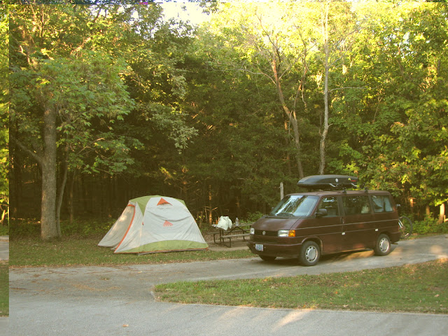
Truman State Park, out a long ridge above the reservoir, camped all
by myself at sunset in a loop in the trees, oak, hickory forest –
serene at the end of a long city day.


Great pictures of Kansas city. I can imagine Mom and the gang living it up there.
ReplyDeletewhat an amazing time for a gal from Scobey!